Rural Roads:
Stream Crossings
Where a road crosses a natural watercourse, provision must be made to carry the water under or across the road. The selection of the best and most appropriate stream crossing design depends on a number of factors, and a poor design choice can result in a costly installation that is subject to failure and may cause significant environmental damage.
Common features of stream crossings that lead to erosion problems include:
- Filled crossings without culverts.
- Crossings with undersized culverts.
- Crossings with culverts susceptible to being plugged.
- Crossings with culvert outlet erosion.
- Crossings with a potential for stream diversion.
- Crossings that have diverted streams.
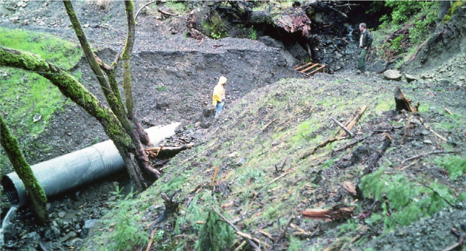
This stream crossing washed out (eroded) when the culvert plugged and streamflow overtopped and scoured through the road fill. Sediment was delivered directly to the stream crossing as the fill eroded. Stream crossings and culverts need to be properly designed, constructed, and maintained to minimize the potential for such failures. (PWA)
Examples of properly designed stream crossings
Culvert re-sizing:
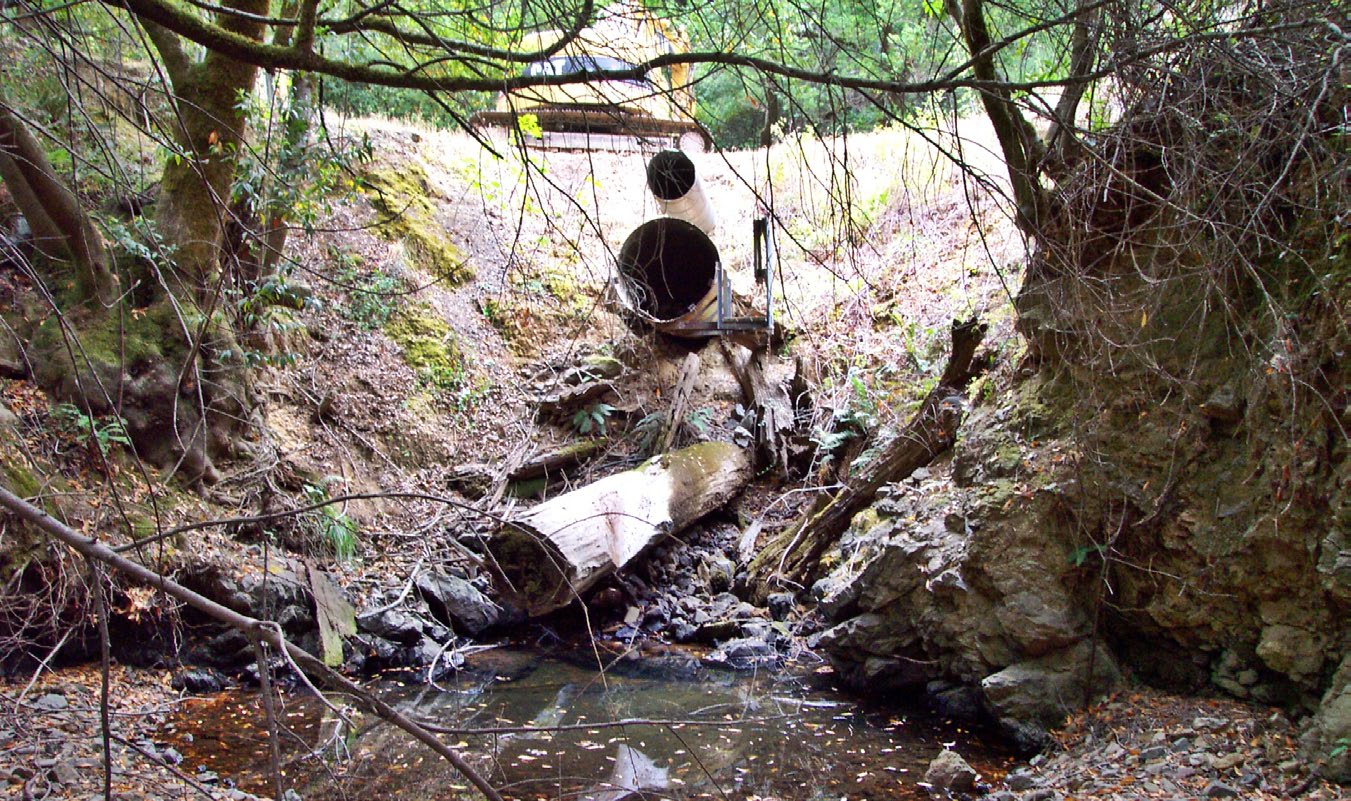
Before: Undersized, perched culvert on a fish bearing stream creating a fish passage barrier. |
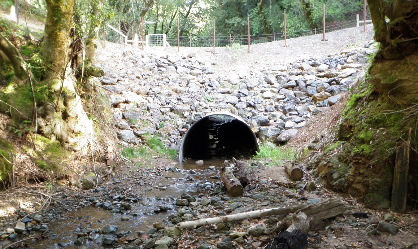
After: Properly sized culvert to pass the 100-year design flow on a fish bearing stream that is installed inline with the natural channel gradient and natural gradient. The culvert is embedded into the streambed to allow fish passage at all stages. The greater than 2:1 slope outboard fillslope is armored with riprap.
|
Bridge installation:
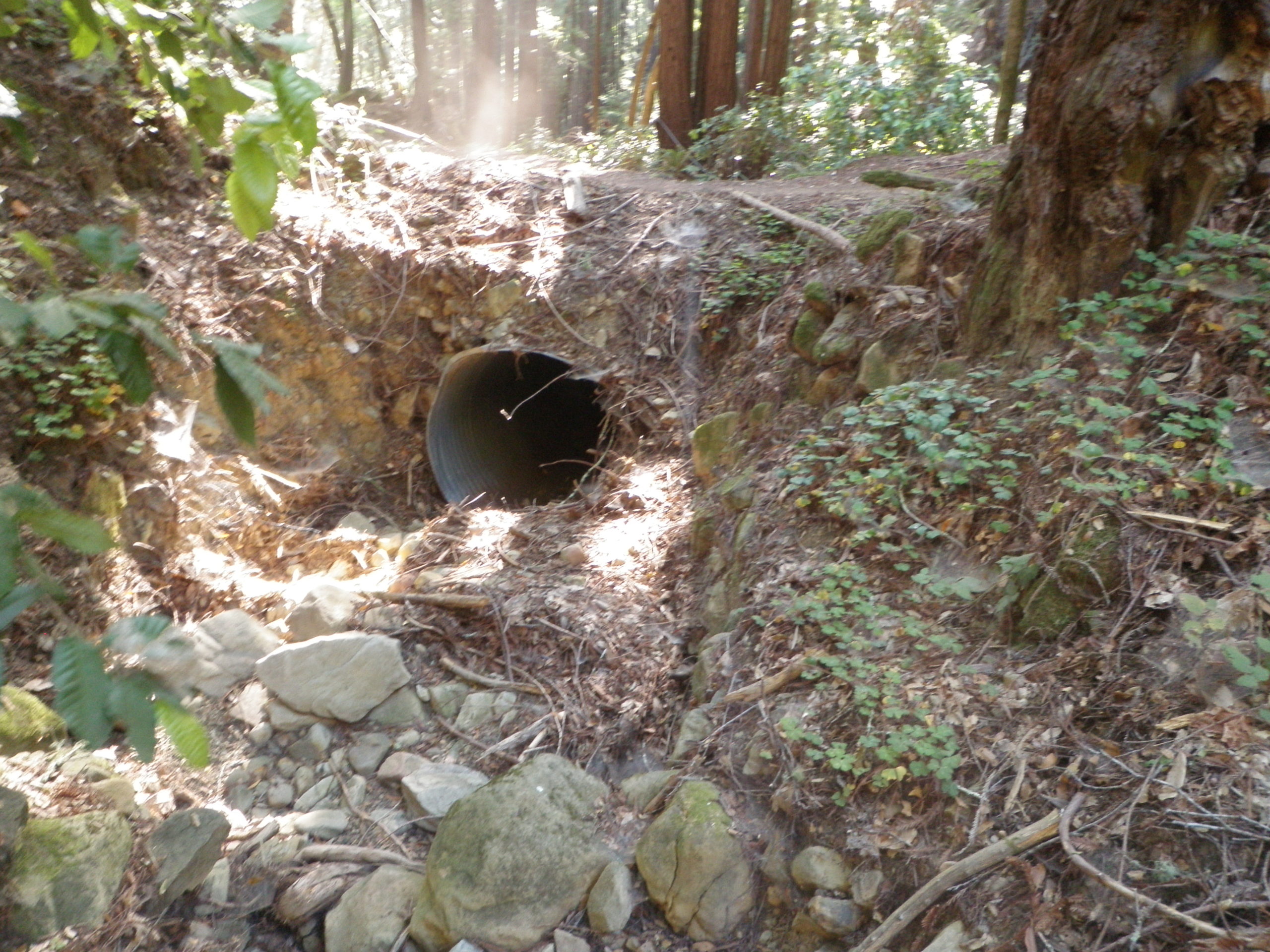
Before: Undersized culvert crossing with steep eroding fillslopes. |
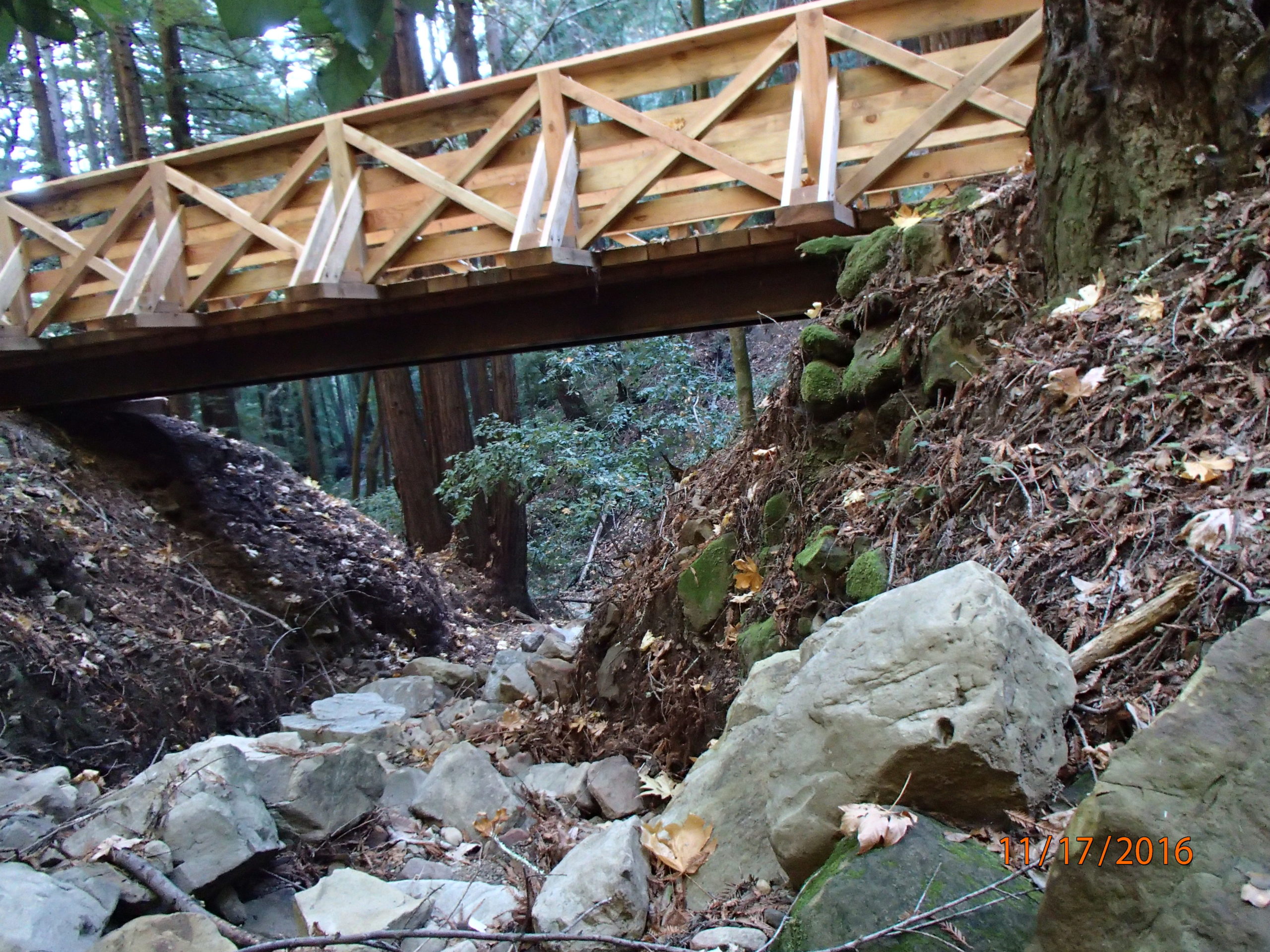
After: During a road to trail conversion, this stream crossing was upgraded to a bridge crossing with the road fill removed and natural channel gradient restored. |
Armored Fill:
 .
. 
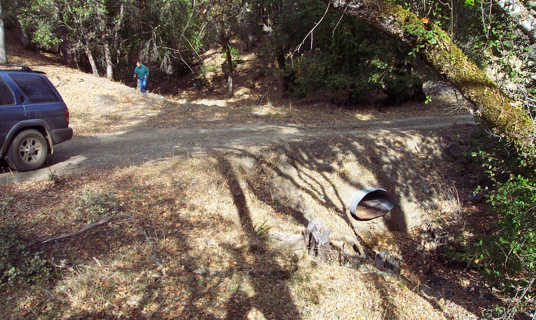
Before: Undersized, perched culvert on an intermittent stream prone to inlet plugging and outlet erosion. |
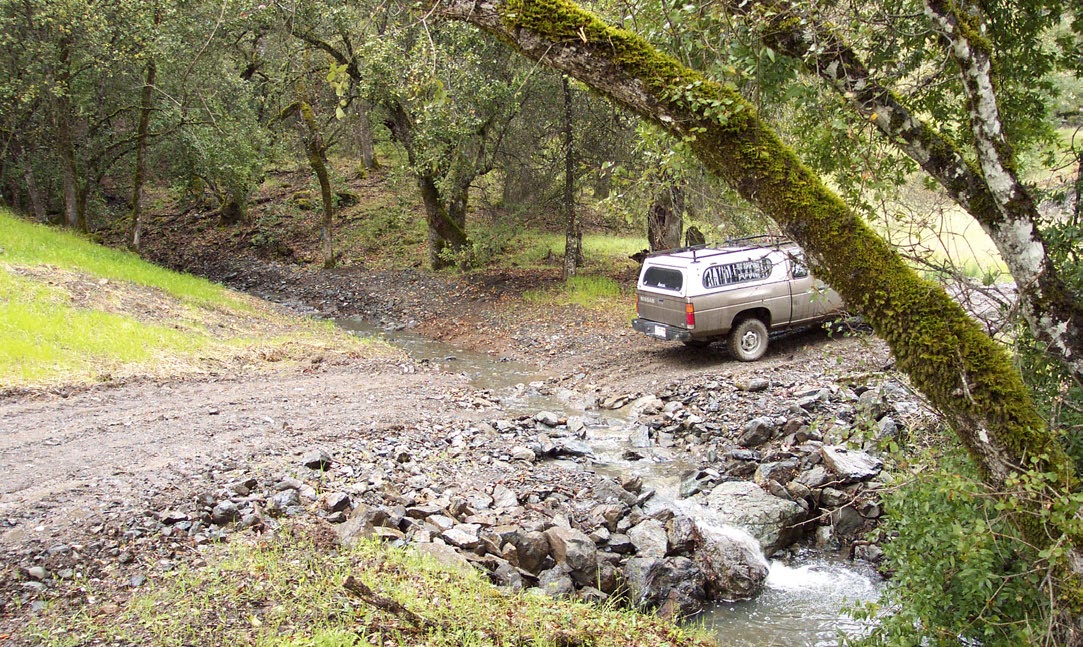
After: Armored fill crossing with enough capacity to pass the 100-year design flow without diverting. Some fill is left in the crossing so vehicles will have a level roadbed to cross the channel. |
Trash Rack:
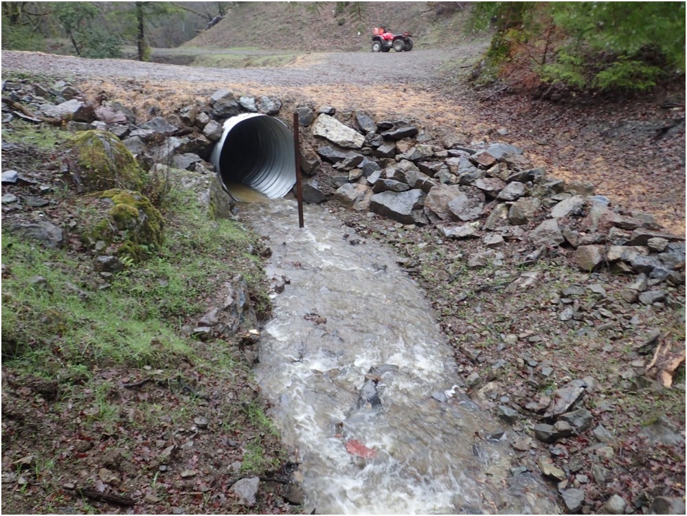
A single post-trash rack installed slightly upstream of the culvert inlet to reduce plug potential.
Critical Dip:
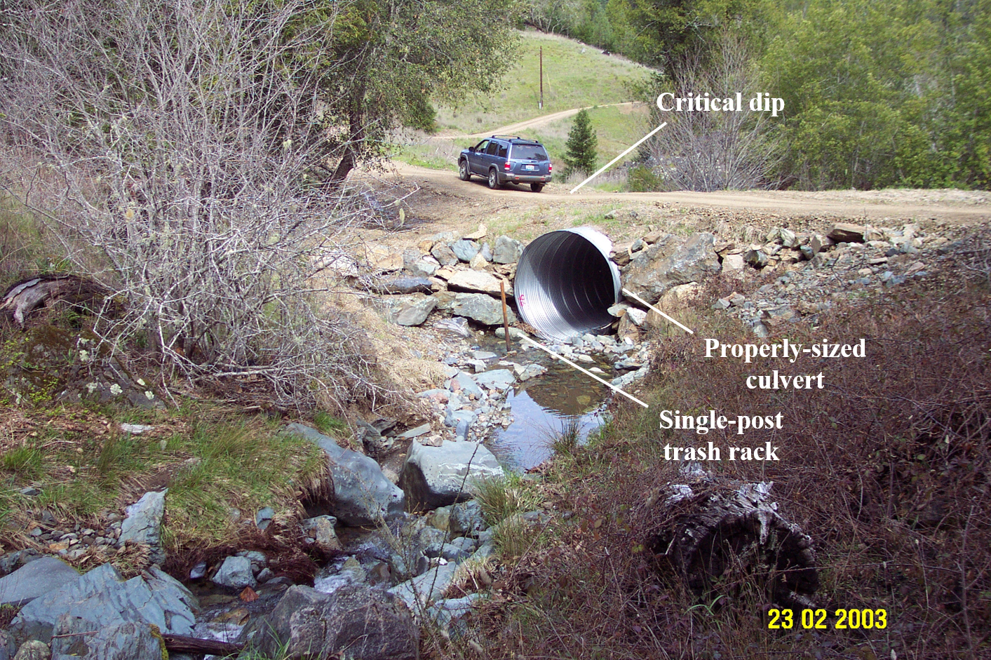
Culvert crossing installed at the base of fill with enough capacity to pass the 100-year design flow. In addition, a trash rack has been installed to prevent culvert plugging, and a critical dip has been added on the down-road hinge line of the fill, preventing stream diversion.
Stream Crossing Decomissioning
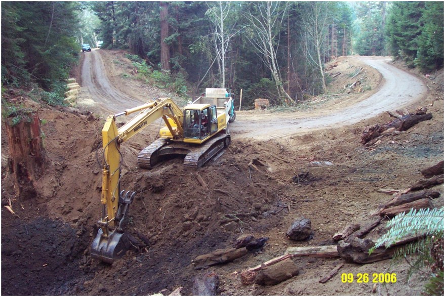
Removing (decommissioning) a stream crossing involves excavating and removing all fill materials placed in the stream channel when the crossing was built. Fill material should be excavated to recreate the original channel grade (slope) and orientation, with a channel bed that is as wide, or slightly wider, than the original watercourse. If the channel sideslopes were disturbed, they should be graded (excavated) back to a stable angle (generally less than 50% (2:1)) to prevent slumping and soil movement. The bare soils should then be mulched, seeded and planted to minimize erosion until vegetation can protect the surface, and the approaching road segments should be cross-road drained to prevent road runoff from discharging across the freshly excavated channel sideslopes.
Here is an example of decomissioning a stream crossing:
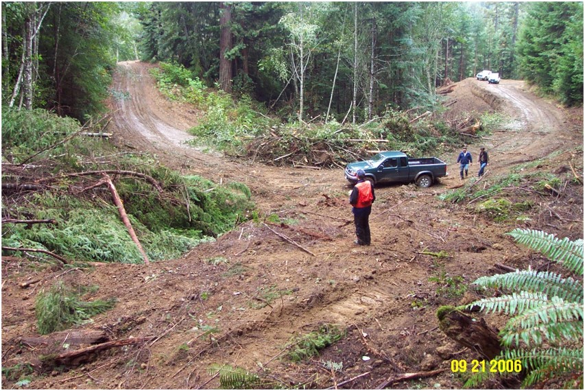
Before the decomissioning.
Once cleared, an excavator excavated the fill material and several dump trucks were used to endhaul spoil material to a nearby, stable disposal site.
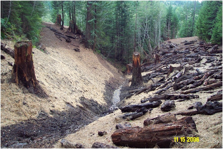
The channel was excavated (exhumed), and the sideslopes were sloped back to stable angles, exposing several buried stumps that signaled the level of the original ground surface. The bare slopes were then seeded, mulched with straw, and planted with trees. All the logs visible on the right bank had been buried in the crossing fill. They were removed and placed on the final ground surface.
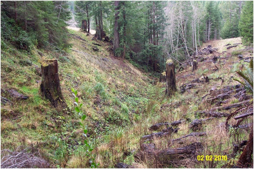
Four years later, the site showed significant revegetation, and minimal channel adjustment (scour) or surface erosion.
What should I do about stream crossing problems?
- Contact the Marin RCD: call, email, or use the submission form in the sidebar of this page.
- Secure permits: This practice always requires permits.
